Garmin Navionics Vision+ US North - 010-C1289-00
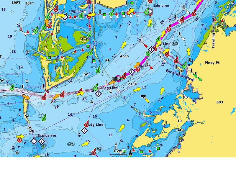
ALL-IN-ONE MAP SOLUTION FOR GARMIN CHARTPLOTTERS
Access detail-rich mapping of coastal features, lakes, rivers and more. Integrated Garmin and Navionics® content offers coverage for boaters worldwide.
DAILY CHART UPDATES
Charts are constantly being enhanced with new and amended content — as many as 5,000 updates are made every day. Your one-year subscription includes access to daily chart updates via the ActiveCaptain app.
AUTO GUIDANCE+ TECHNOLOGY
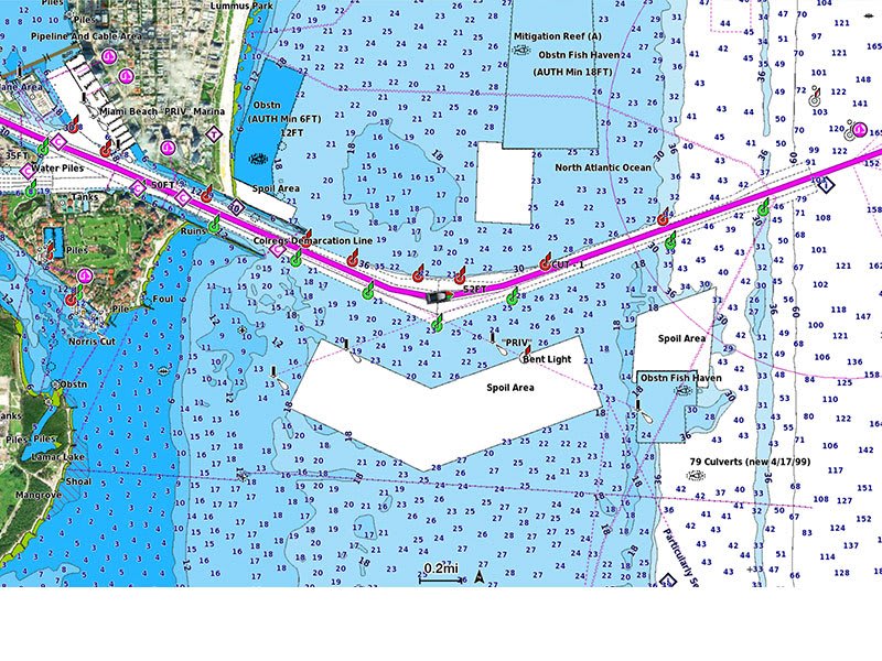
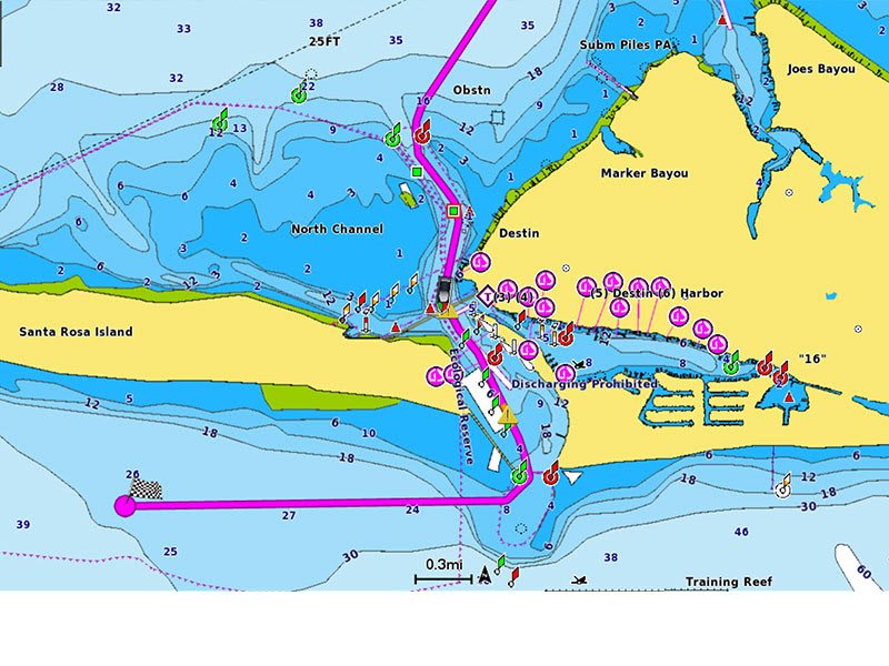
Combining the best of Garmin and Navionics automatic routing features, built-in Auto Guidance+ technology2 gives you a suggested dock-to-dock path to follow through channels, inlets, marina entrances and more.
DEPTH RANGE SHADING
High-resolution depth range shading lets you select up to 10 color-shaded options and view your designated target depths at a glance.
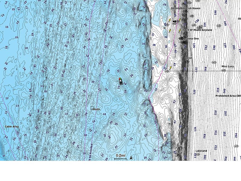
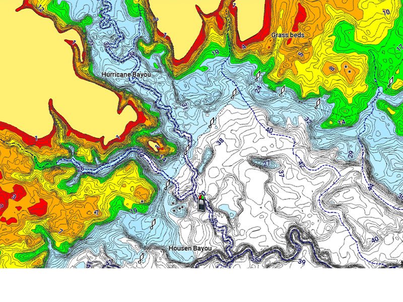
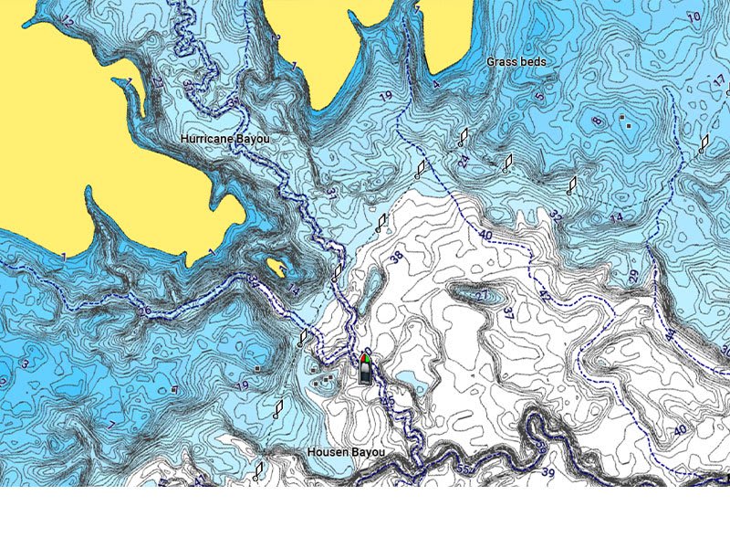
UP TO 1’ CONTOURS
For improved fishing and navigation, up to 1' contours provide a clear depiction of bottom structure for improved fishing charts and enhanced detail in swamps, canals, harbors, marinas and more.
SHALLOW WATER SHADING
To give a clear picture of shallow waters to avoid, this feature allows for shading at a user-defined depth.
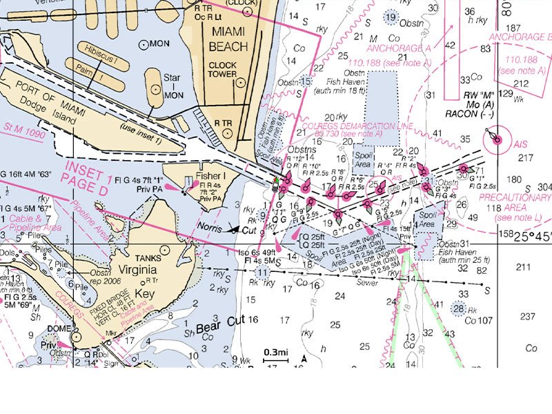
RASTER CARTOGRAPHY
NOAA raster cartography3 is available for some U.S. waters as a free downloadable feature via the ActiveCaptain app to provide paper chart-like views on your plotter.
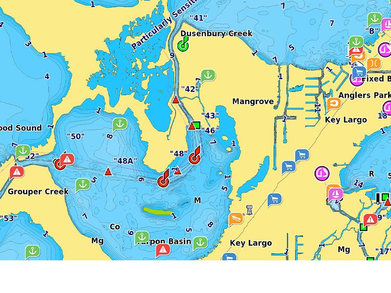
ACTIVECAPTAIN COMMUNITY
Community-sourced content provides useful POIs, such as marinas, anchorages, hazards, businesses and more. Get recommendations from boaters with firsthand experience of the local environment.
Product Information
Product Information
Shipping & Returns
Shipping & Returns
Description
ALL-IN-ONE MAP SOLUTION FOR GARMIN CHARTPLOTTERS
Access detail-rich mapping of coastal features, lakes, rivers and more. Integrated Garmin and Navionics® content offers coverage for boaters worldwide.
DAILY CHART UPDATES
Charts are constantly being enhanced with new and amended content — as many as 5,000 updates are made every day. Your one-year subscription includes access to daily chart updates via the ActiveCaptain app.
AUTO GUIDANCE+ TECHNOLOGY
Combining the best of Garmin and Navionics automatic routing features, built-in Auto Guidance+ technology2 gives you a suggested dock-to-dock path to follow through channels, inlets, marina entrances and more.
DEPTH RANGE SHADING
High-resolution depth range shading lets you select up to 10 color-shaded options and view your designated target depths at a glance.
UP TO 1’ CONTOURS
For improved fishing and navigation, up to 1' contours provide a clear depiction of bottom structure for improved fishing charts and enhanced detail in swamps, canals, harbors, marinas and more.
SHALLOW WATER SHADING
To give a clear picture of shallow waters to avoid, this feature allows for shading at a user-defined depth.
RASTER CARTOGRAPHY
NOAA raster cartography3 is available for some U.S. waters as a free downloadable feature via the ActiveCaptain app to provide paper chart-like views on your plotter.
ACTIVECAPTAIN COMMUNITY
Community-sourced content provides useful POIs, such as marinas, anchorages, hazards, businesses and more. Get recommendations from boaters with firsthand experience of the local environment.