1 / 2
Minnesota Fly Fishing Maps
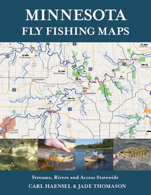
- Spiral bound, lay-flat book to take along on your next trip or plan at home.
- Over 70 pages of full color maps tailored for the Minnesota fly angler.
- Access, easements, boat launches, public land, campgrounds, hiking trails and more.
- Trout streams throughout the state, including the North Shore of Lake Superior and the Driftless Area.
- Warmwater locations such as the Mississippi and St. Croix Rivers, Driftless rivers like the Root River, and outstate locations.
- Over 650 streams, rivers, lakes and locations indexed for easy navigation.
$8.38
Original: $27.95
-70%Minnesota Fly Fishing Maps—
$27.95
$8.38Product Information
Product Information
Shipping & Returns
Shipping & Returns
Description
- Spiral bound, lay-flat book to take along on your next trip or plan at home.
- Over 70 pages of full color maps tailored for the Minnesota fly angler.
- Access, easements, boat launches, public land, campgrounds, hiking trails and more.
- Trout streams throughout the state, including the North Shore of Lake Superior and the Driftless Area.
- Warmwater locations such as the Mississippi and St. Croix Rivers, Driftless rivers like the Root River, and outstate locations.
- Over 650 streams, rivers, lakes and locations indexed for easy navigation.