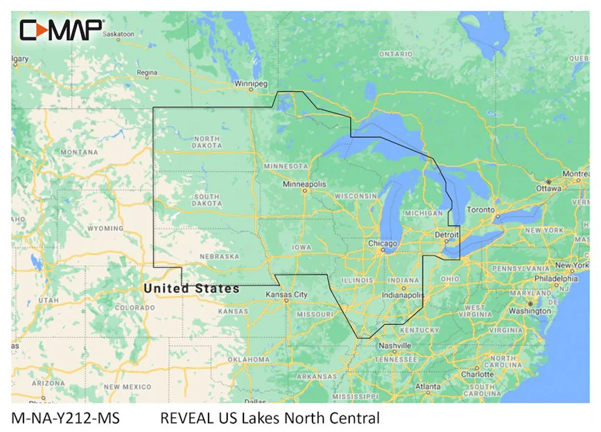
C-Map Reveal US Lakes North
Cruising, fishing or sailing, C-MAP® REVEAL™ Lakes charts offer the very best of C-MAP. With Shaded Relief, including game-changing Reveal Seafloor Imagery, Aerial Photography and Satellite Overlay presentation added to the core C-MAP features found in DISCOVER™ – full-featured Vector Charts, with Custom Depth Shading and subscription-free Easy Routing™. It also includes the very best of C-MAP High-Res Bathy, including integrated Genesis® data. Purchase includes a full 12 months of online updates.
Compatible with Lowrance, Simrad & B&G Chartplotters.
Original: $179.99
-70%$179.99
$54.00Product Information
Product Information
Shipping & Returns
Shipping & Returns
Description
Cruising, fishing or sailing, C-MAP® REVEAL™ Lakes charts offer the very best of C-MAP. With Shaded Relief, including game-changing Reveal Seafloor Imagery, Aerial Photography and Satellite Overlay presentation added to the core C-MAP features found in DISCOVER™ – full-featured Vector Charts, with Custom Depth Shading and subscription-free Easy Routing™. It also includes the very best of C-MAP High-Res Bathy, including integrated Genesis® data. Purchase includes a full 12 months of online updates.
Compatible with Lowrance, Simrad & B&G Chartplotters.